Link Copied!
Alan MacEachren Quotes (1952-)
Director, King
About Alan MacEachren
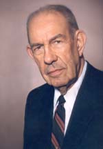
Alan M. MacEachren (born 1952) is an American geographer, Professor of Geography and Director, GeoVISTA Center, Department of Geography, The Pennsylvania State University. He is known for his cross-disciplinary work in the fields of human-centered geographic visualization, scientific and information visualization, and in statistics.
Best Alan MacEachren Quotes
Shortest
Earliest
Explore our curated collection of the most famous and impactful Alan MacEachren quotes.
“Without categorization, maps would not be possible.”
“To make maps that work, we must depict categories using methods that match the structures of human mental categorization.”
“It may be that the human brain not only perceives but stores the essentials of a visual scene using the same geometrical, quasi-symbolic, minimalist vocabulary found in maps.”
“Maps, due to their melding of scientific and artistic approaches, always involve complex interaction between the denotative and the connotative meanings of signs they contain.”
“The fact that map is a fuzzy and radial, rather than a precisely defined, category is important because what a viewer interprets a display to be will influence her expectations about the display and how she interacts with it.”

“Understanding how maps work and why maps work (or do not work) as representations in their own right and as prompts to further representations, and what it means for a map to work, are critical issues as we embark on a visual information age.”

“Cartography as a discipline has a significant stake in the evolving role of maps within systems for scientific visualization, within spatial decision support systems, within hypermedia information access systems, and within virtual reality environments.”

“The representational nature of maps, however, is often ignored – what we see when looking at a map is not the word, but an abstract representation that we find convenient to use in place of the world. When we build these abstract representations we are not revealing knowledge as much as are creating it.”
“When visualization tools act as a catalyst to early visual thinking about a relatively unexplored problem, neither the semantics nor the pragmatics of map signs is a dominant factor. On the other hand, syntactics (or how the sign-vehicles, through variation in the visual variables used to construct them, relate logically to one another) are of critical importance.”
“Exploring maps as representation forges important links between cartography and a variety of cognate fields concerned with this topic in its various facets (including geographical information systems [GIs] and remote sensing, as well as art, cognitive science, sociology, cognitive and environmental psychology, semiotics, and even the history and philosophy of science).”

“The nature of maps and of their use in science and society is in the midst of remarkable change - change that is stimulated by a combination of new scientific and societal needs for geo-referenced information and rapidly evolving technologies that can provide that information in innovative ways. A key issue at the heart of this change is the concept of "visualization."”

“Two developments of the past four decades played crucial roles in establishing a research agenda for the study of map symbolization and design. The first was Arthur H. Robinson's dissertation (published as The Look of Maps in 1952), with its call for objective research, and the second was the adoption in the 1970s of a paradigm of cartography as communication science.”

“Geovisualization integrates approaches from visualization in scientific computing (ViSC), cartography, image analysis, information visualization, exploratory data analysis (EDA), and geographic information systems (GISystems) to provide theory, methods, and tools for visual exploration, analysis, synthesis, and presentation of geospatial data (any data having geospatial referencing).”
“During the 1960s and 1970s, when cartographers were embracing the communication model and a behavioral approach to empirical research, psychology was undergoing a revolution in its perspective on what to study and how to study it. Psychologists began to realize that stimulus-response laws do not explain human perception or behavior (any more than the gravity models used by geographers can explain spatial interaction).”
“Cartography is about representation. This statement may seem obvious, but it has been overlooked in our search for organizing principles for the field. Rather than restricting research in cartography to maps that present well-defined messages (and suggesting a single, map-engineering approach to improving the transmission of these messages, as the communication approach did), attention to maps as spatial representation expands the field.”
“Maps have been a successful form of representation for centuries by making the world understandable through systematic abstraction that retains the iconicity of space depicting space. Advances in methods and technologies are blurring the lines among maps and other forms of visual representation and pushing the bounds of “map” as a concept toward both more realistic and more abstract depiction. As a result, there are a variety of unanswered questions about the attributes and implications of “maps.””
“Treating cartography as a formal communication system implies that we can improve map communication if we can reduce the filtering or loss of information at various points in the system where in the system should have a positive effect, and an information loss should be impossible to overcome. Most efforts to study cartographic communication have been directed to the middle stages in the system: the cartographer's transformation of selected information into the map and the initial extraction of information from the map by the user.”
“Jacques Bertin's books Semiology of Graphics and Graphics and Graphic Information Processing have been stimuli for my own thinking about the representation and analysis of geographic information. I have also used both books as core readings for graduate seminars and they have generated lively discussion and prompted innovative research. I often ask graduate students to consider how cartographic research and practice in the U.S. might be different today if the English edition of Semiology of Graphics had appeared in 1967 (when it was published in French), rather than in 1983. I know that my own work would have been dramatically different if I had encountered these ideas a decade and a half sooner.”
“Use of the term visualization in the cartographic literature can be traced back at least four decades (Philbrick, 1953). It was the 1987 publication of a report by the U. S. National Science Foundation, however, that established a new meaning for this term in the context of scientific research (McCormick et al., 1987). The report, produced by a committee containing no cartographers, emphasized the role of computer display technology in prompting mental visualization - and subsequent insight. Scientific visualization has, thus, been defined as the use of sophisticated computing technology to create visual displays, the goal of which is to facilitate thinking and problem solving. Emphasis is not on storing knowledge but on knowledge construction.”
“Many pressing problems facing science and society are inherently geospatial – location matters. The availability of essential geospatial data has increased dramatically over the past decade. Both scientific progress and application of geospatial information to societal needs remains hampered, however, due to the lack of methods for transforming these data into information and for combining information from diverse sources to construct knowledge. Progress requires fundamental breakthroughs in both geovisualization and its integration with other methods for geospatial knowledge construction. The research agenda delineated in this issue is a step toward achieving these breakthroughs. Identifying the challenges is the easy part. Meeting them is unlikely without a commitment to a coordinated approach, by both individuals and organizations in multiple countries.”
“A new view of the role of art and science in cartography is clearly needed. It is probably a mistake to view maps as objects that contain varied amounts of scientific or artistic content for which we must determine an appropriate balance (as both Keates, 1984, and Robinson, 1952, seem to, with Keates arguing for more art and Robinson for more science). Instead, it makes more sense to consider complementary artistic and scientific approaches to studying and improving maps, both of which can be applied to any given cartographic problem. The artistic approach is intuitive and holistic, achieving improvements through experience supplemented by critical examination (where critical examination implies expert appraisal of the results of our cartographic decision-making efforts). It draws on science in using perspective, understanding of human vision, color theory, and so on.”
“According to Charles W. Morris, syntactics is the relation between a given sign-vehicle and other sign-vehicles. There is a critical distinction here (that many cartographers have missed) between Morris's "syntactics" and the linguistic subcategory of "syntax". While syntax puts emphasis on word order and parsing (i.e., on a linear sequence), syntactics is much broader in scope. Syntactics allows for any kind of among-sign relationships. Morris (1938, p. 16) makes this point explicitly in his statement that there are "syntactical problems in the fields of perceptual signs, aesthetic signs, the practical use of signs, and general linguistics."... At least three kinds of sign relationships seem to fall under Morris's umbrella of syntactics (Posner, 1985, in French; cited in Nöth, 1990, p. 51). These include: (1) ”the consideration of signs and sign combinations so far as they are subject of syntactical rules” (Morris, 1938, p. 14), (2) ”the way in which signs of various classes are combined to form compound signs” (Morris, 1946/1971, p. 367), and (3) ”the formal relations of signs to one another” (Morris, 1938, p. 6).”
“Robinson (1952) pointed out some limits to approaching map symbolization and design from a purely artistic viewpoint, as he suggested was the guiding perspective at the time. Maps, like buildings that are designed primarily for artistic impact, are often not functional... Robinson (1952) argued that treating maps as art can lead to "arbitrary and capricious" decisions. He saw only two alternatives: either standardize everything so that no confusion can result about the meaning of symbols, or study and analyze characteristics of perception as they apply to maps so that symbolization and design decisions can be based on "objective" rules... Robinson's dissertation, then, signaled the beginning of a more objective approach to map symbolization and design based on testing the effectiveness of alternatives, an approach that followed the positivist model of physical science. In his dissertation, Robinson cited several aspects of cartographic method for which he felt more objective guidelines were required (e.g., lettering, color, and map design). He also suggested that this objective look at cartographic methods should begin by considering the limitations of human perception. One goal he proposed was identification of the "least practical differences" in map symbols (e.g., the smallest difference in lettering size that would be noticeable to most readers).”

Alan MacEachren Quotes by Topic
Find exactly what you are looking for by browsing this categorized list of Alan MacEachren quotes by topic.
Alan MacEachren on Map 3 quotes
“The fact that map is a fuzzy and radial, rather than a precisely defined, category is important because what a viewer interprets a display to be will influence her expectations about the display and how she interacts with it.”

Alan MacEachren on Information age
“Understanding how maps work and why maps work (or do not work) as representations in their own right and as prompts to further representations, and what it means for a map to work, are critical issues as we embark on a visual information age.”

Alan MacEachren on Visualization
“Understanding how maps work and why maps work (or do not work) as representations in their own right and as prompts to further representations, and what it means for a map to work, are critical issues as we embark on a visual information age.”
Alan MacEachren on Visual thinking
“When visualization tools act as a catalyst to early visual thinking about a relatively unexplored problem, neither the semantics nor the pragmatics of map signs is a dominant factor. On the other hand, syntactics (or how the sign-vehicles, through variation in the visual variables used to construct them, relate logically to one another) are of critical importance.”
What Alan MacEachren Said About Others
Discover personal opinions Alan MacEachren shared regarding contemporaries.
Alan MacEachren on Jacques Bertin
“His books Semiology of Graphics and Graphics and Graphic Information Processing have been stimuli for my own thinking about the representation and analysis of geographic information. I have also used both books as core readings for graduate seminars and they have generated lively discussion and prompted innovative research. I often ask graduate students to consider how cartographic research and practice in the U.S. might be different today if the English edition of Semiology of Graphics had appeared in 1967 (when it was published in French), rather than in 1983. I know that my own work would have been dramatically different if I had encountered these ideas a decade and a half sooner.”

Alan MacEachren on Charles W. Morris
“According to Morris, syntactics is the relation between a given sign-vehicle and other sign-vehicles. There is a critical distinction here (that many cartographers have missed) between Morris's "syntactics" and the linguistic subcategory of "syntax". While syntax puts emphasis on word order and parsing (i.e., on a linear sequence), syntactics is much broader in scope. Syntactics allows for any kind of among-sign relationships. Morris (1938, p. 16) makes this point explicitly in his statement that there are "syntactical problems in the fields of perceptual signs, aesthetic signs, the practical use of signs, and general linguistics."... At least three kinds of sign relationships seem to fall under Morris's umbrella of syntactics (Posner, 1985, in French; cited in Nöth, 1990, p. 51). These include:
(1) ”the consideration of signs and sign combinations so far as they are subject of syntactical rules” (Morris, 1938, p. 14),
(2) ”the way in which signs of various classes are combined to form compound signs” (Morris, 1946/1971, p. 367), and
(3) ”the formal relations of signs to one another” (Morris, 1938, p. 6).”
Alan MacEachren on Arthur H. Robinson
“Two developments of the past four decades played crucial roles in establishing a research agenda for the study of map symbolization and design. The first was Arthur H. Robinson's dissertation (published as The Look of Maps in 1952), with its call for objective research... Robinson (1952) pointed out some limits to approaching map symbolization and design from a purely artistic viewpoint, as he suggested was the guiding perspective at the time. Maps, like buildings that are designed primarily for artistic impact, are often not functional... Robinson (1952) argued that treating maps as art can lead to "arbitrary and capricious" decisions. He saw only two alternatives: either standardize everything so that no confusion can result about the meaning of symbols, or study and analyze characteristics of perception as they apply to maps so that symbolization and design decisions can be based on "objective" rules... Robinson's dissertation, then, signaled the beginning of a more objective approach to map symbolization and design based on testing the effectiveness of alternatives, an approach that followed the positivist model of physical science. In his dissertation, Robinson cited several aspects of cartographic method for which he felt more objective guidelines were required (e.g., lettering, color, and map design). He also suggested that this objective look at cartographic methods should begin by considering the limitations of human perception. One goal he proposed was identification of the "least practical differences" in map symbols (e.g., the smallest difference in lettering size that would be noticeable to most readers).”
About Alan MacEachren
Alan M. MacEachren (born 1952) is an American geographer, Professor of Geography and Director, GeoVISTA Center, Department of Geography, The Pennsylvania State University. He is known for his cross-disciplinary work in the fields of human-centered geographic visualization, scientific and information visualization, and in statistics.